The Best Trail-Running Spots For Londoners
Take a break from the capital’s roads and murky air
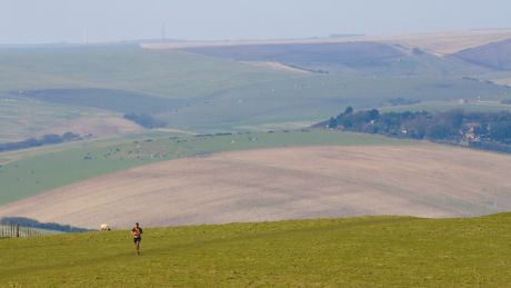
Photograph: James Boyes via Flickr (creative commons)
For London runners heading off-road tends to be a rare luxury rather than a weekly event. The reason for this is obvious – most people tend to run near their house, and in London those surfaces are mostly paved.
However, it’s worth making the effort to get out on the trails for your run more often, because it’s a very different experience to running in the city.
A bit of investigation into your area could well reveal parks with good off-road tracks, and if you’re prepared to jump on a train or in a car, some of the finest National Trails in the UK are less than an hour from the capital.
To help you on your way Ross Macdonald, a runner and ambassador for plant-based Clif Bar energy bars, has put together this entirely off-road route around several scenic commons in Surrey. And after that we’ve added a few of our own suggestions of top trail-running spots in and around London.
Surrey Commons Trail Running Route
The route is 16.7km and mostly flat, and if that seems a bit long there are a few chances to shorten it along the way. It starts from Esher station, which is half an hour on the train from London Waterloo. There are directions below, or you can find the route on MapMyRun.
From Esher station, make your way south across Littleworth and Arbrook Commons. Use Birchwood Lane to navigate your way under the A3 and into Prince’s Covert.
Get the Coach Newsletter
Sign up for workout ideas, training advice, reviews of the latest gear and more.
Head towards Oxshott and loop around Oxshott Heath, then take one of the pedestrian bridges to access Esher Common until you’re back north of the A3.
Take the path south of Black Pond and then cross Portsmouth Road into West End Common, running until you meet the stream.
Turn right, keeping to this path until you reach West End Recreation Ground, then run to Esher Green and turn left into More Lane.
Follow this road for one mile (1.6km) on the north side of Sandown Park until you arrive back at Esher station.
This route can be extended by adding Ashtead Common between Prince’s Covert and Oxshott, or shortened by remaining north of the A3 and running from Arbrook Common directly into Esher Common.
Hampstead Heath
North London’s running mecca, Hampstead Heath contains kilometres of trails through woods and fields, and plenty of ups and downs, including Parliament Hill, which provides a breathtaking view of the city. It’s also easy to plan a run that takes in the Heath as well as the trails of Alexandra Palace Park and Highgate Woods, with minimal time spent on the roads in between.
How to get there: Hampstead Heath Overground is the closest station, but it’s also a short walk from Belsize Park on the Northern Line.
Richmond Park
As Hampstead Heath is to north London runners, Richmond Park is to those in the south. The largest of London’s Royal Parks has plenty to offer trail runners with the Tamsin Trail – a 12km path around the perimeter – being a great place to start. Wimbledon Common and Bushy Park are both also nearby, if you want to plan an especially long trail run.
How to get there: You can get a train to Richmond or Mortlake rail station from Victoria. Richmond station is also on the District and Overground lines.
Epping Forest
Tucked away in the north-east corner of London, Epping Forest is easily accessed via the Central Line and criss-crossed by a network of well-marked trails that offer a wide variety of running routes. There are around 6,000 acres of forest to explore, but it’s wise to start with one of the nine way-marked trails – details and maps for each of them can be found on the City of London website.
How to get there: Jump on the Central Line to Debden or get an Overground train to Chingford from Liverpool Street.
North Downs
Head directly south from anywhere in London and you’ll run into the North Downs, a ridge of hills that run from Farnham in Surrey to the coast at Dover in Kent. The 246km North Downs Way is a trail runs the entire length of the ridge and is specifically designed to offer the best views for those who walk or run along it (plan a section on nationaltrail.co.uk). The Surrey Hills Area of Outstanding Natural Beauty is also in the North Downs and contains the trail-running hotspots of the Devil’s Punchbowl and Box Hill.
How to get there: You can get a train to Farnham from Waterloo, or for the other end of the North Downs Way go from St Pancras, Charing Cross or Victoria to Dover Priory.
South Downs
As with the North Downs, there is a trail that spans the entire length of the South Downs – the South Downs Way. The 160km route runs from Winchester in Hampshire to the East Sussex coast at Eastbourne. There are regular trains from London to either end of the trail, or you can join the trail at Petersfield, Amberley, Hassocks or Lewes along the way.
How to get there: Waterloo is the best station for getting to Winchester. For Eastbourne, take a train from Victoria. One of those two London stations will be your best bet for any stops along the South Downs Way too.

Nick Harris-Fry is a journalist who has been covering health and fitness since 2015. Nick is an avid runner, covering 70-110km a week, which gives him ample opportunity to test a wide range of running shoes and running gear. He is also the chief tester for fitness trackers and running watches, treadmills and exercise bikes, and workout headphones.

